
How Weather Satellites Help Predict Fall Flood Patterns
• Weather satellites provide real-time data on precipitation, cloud cover, and soil moisture, crucial for predicting fall flood patterns.
• Satellite data enhances hydrological models, improving the accuracy of flood forecasts and enabling early warning systems.
• GOES, POES, and GPM are examples of weather satellites that contribute significantly to flood prediction efforts.
Weather satellites predict fall flood patterns effectively
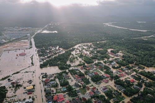
Fall, known for colorful foliage and crisp air, also brings rainfall and flood risks. Predicting floods is key to protecting communities and infrastructure. Weather satellites are vital for providing data to forecast fall flood patterns accurately.
Related News